#Design#
Vahrenwalder Strasse is the main traffic artery that connects Hanover from north to south. Under the enormous pressure of traffic, the road has torn the city apart. The current state of Vahrenwalder Strasse is due to the traffic changes of the last century, so what does the future look like in the course of social development?
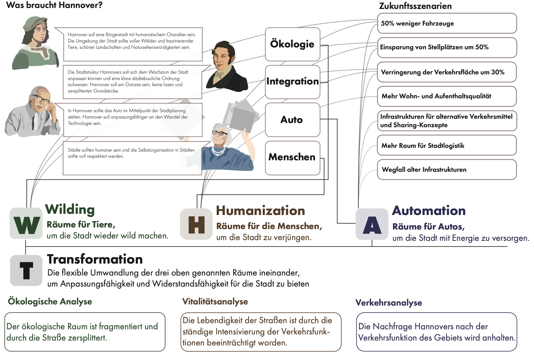
First, ecological spaces should be integrated and "animal-aided" designed. An ecological corridor will be created in harmony with the overall urban structure of Hanover.
Second, both sides of the road should be connected. The residents should get more living space and the streets in the district should be pedestrian-friendly. In this way, the entire street is activated.
Thirdly, the traffic routing should be renewed. Due to the location of the road, traffic demand should continue to be guaranteed, and new technologies support the efficient operation of the traffic facilities.
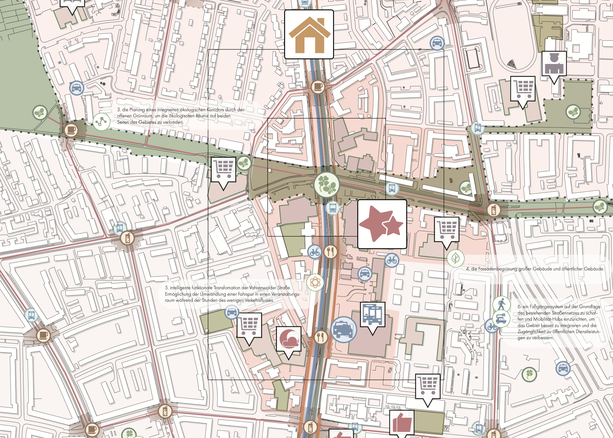
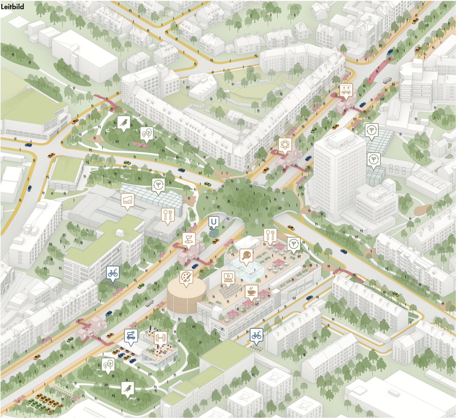
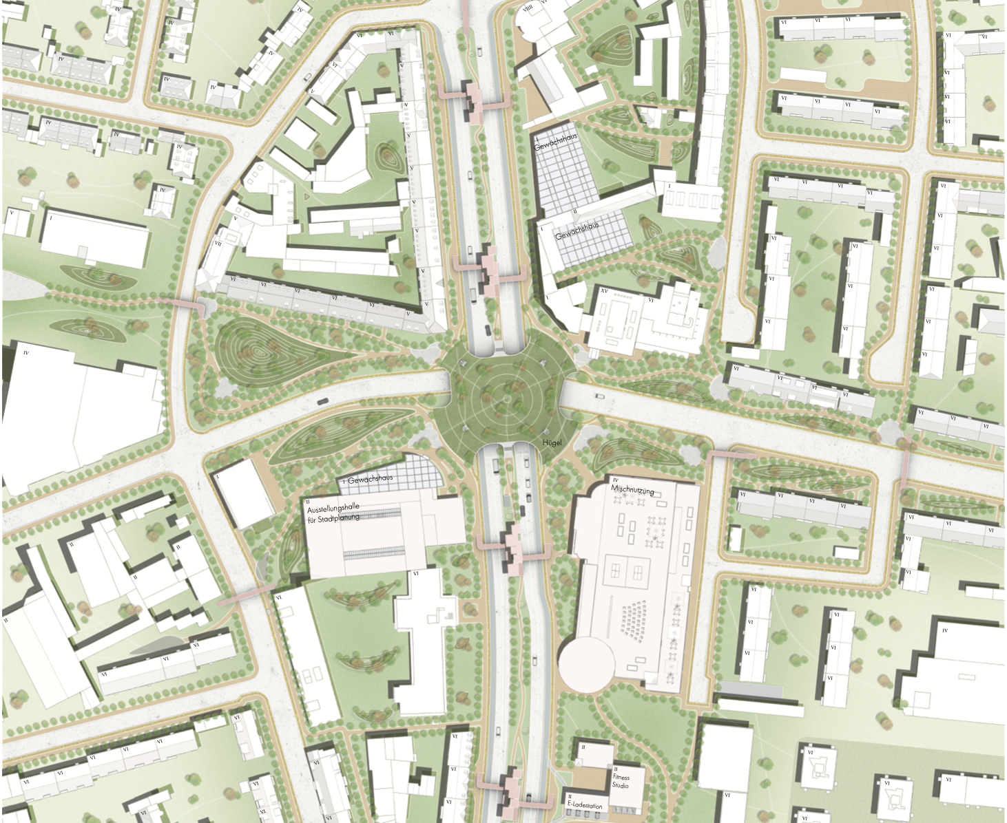
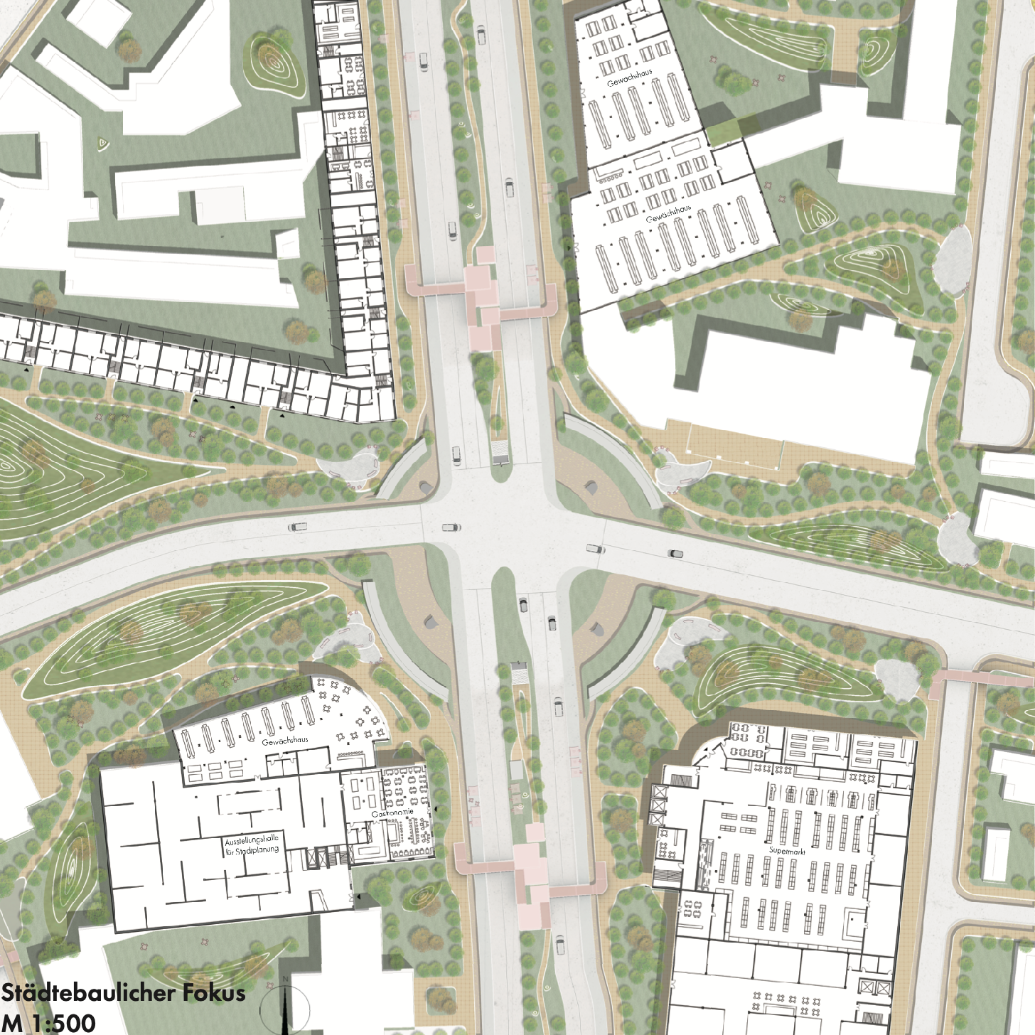
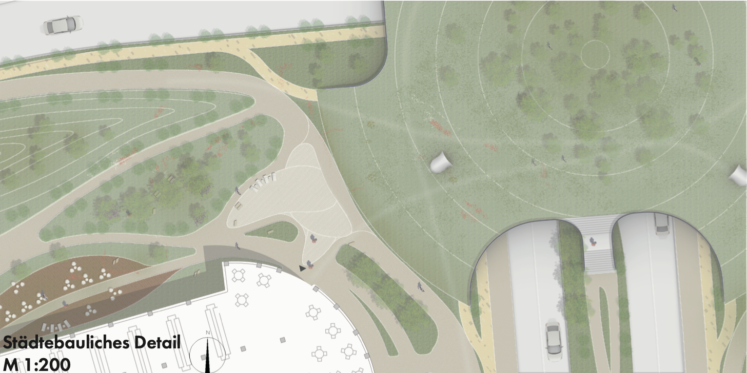
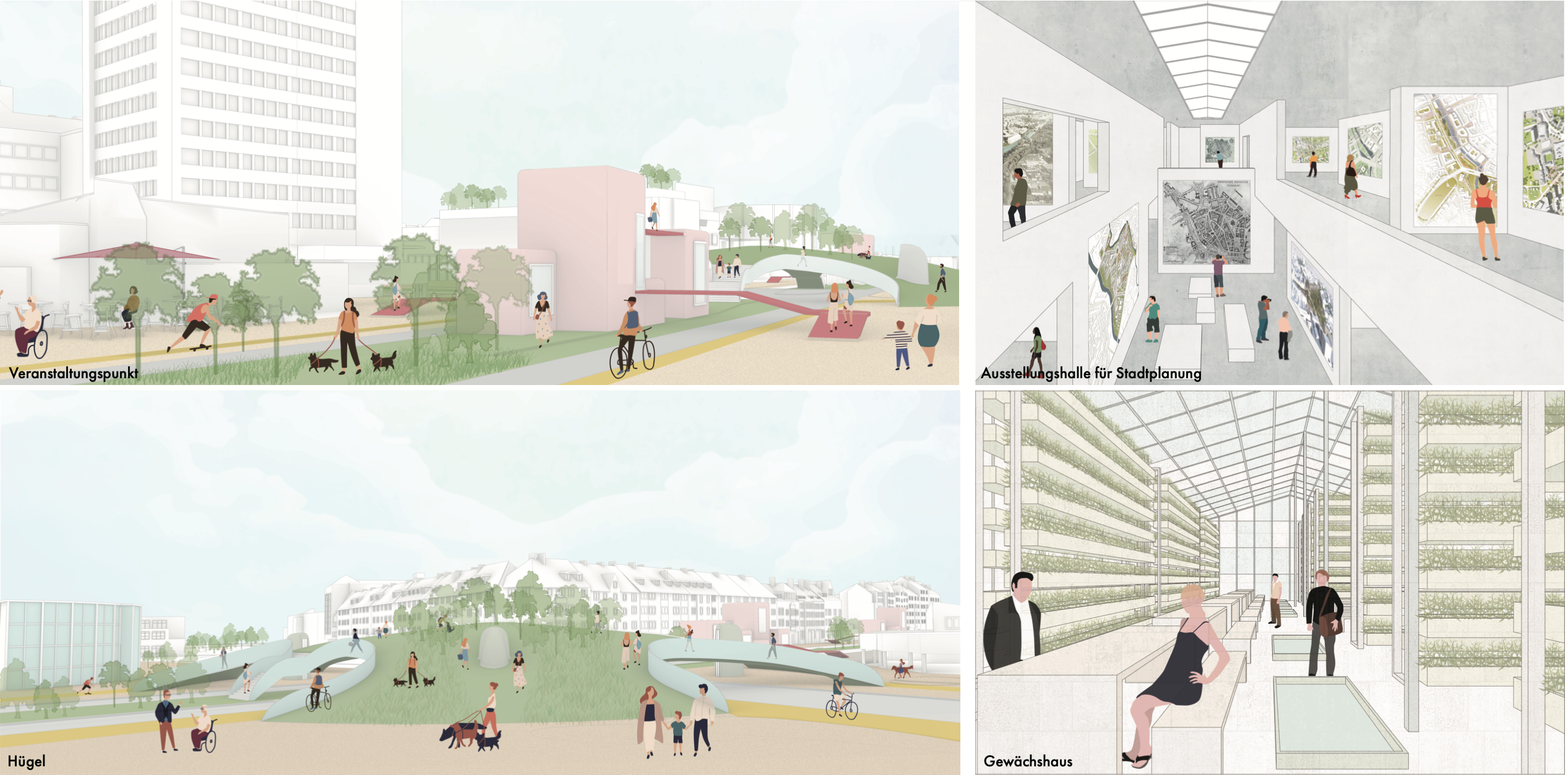
Based on these three concepts, we design a hill at the central intersection. It will connect the surroundings like a wild bridge and is also an important node of the ecological corridor, which forms a network together with the ecological points scattered over the area. With the hill as the centerpiece, existing areas such as parking lots and squares in the area will be naturalized to varying degrees to accommodate the needs of various animals such as insects, forest animals, domestic animals and birds. At the same time, pedestrian and vehicle traffic can be separated. The formerly above-ground subway will be moved underground and an underground system of automated parking, logistics and waste disposal will be built around it.
More space will be unlocked: on the one hand, the former subway square will be transformed into a linear park, on the other hand, the number of lanes will be automatically adjusted according to traffic demand, based on the road management mode of mobile devices. There will be a series of venues along the linear park, providing residential services and activity spaces for residents. Combined with the APP, residents can book their own venues and activity modules to run pop-ups. This creates more mixed-use spaces.
On an architectural level, the north side of the dealership is converted into a greenhouse to support the ecological space. The south side has been converted into an exhibition hall for urban planning, which will show the development of Vahrenwalder Strasse. The existing supermarket on the east side of Vahrenwalder Straße will be retained, while new functions such as co-working spaces and a fitness studio will be added. Rooftop parking spaces will be converted into a public event space and the ramp to the parking lot will be used as a gallery. The gas station will be converted into a charging station. At the same time, the existing parking station for public transport will become a mobility hub in the area.
All strategies have a fourfold focus, namely "W.H.A.T.". "W" stands for "wilding" and design for animals, "H" stands for "humanization" and design for residents, "A" stands for "automation" of mobility and "T" stands for the possibility of functional "transformation". This is the future of Vahrenwalder Strasse as we envision it.
Concept
Rahmenplan (master plan)
Leitbild (mission statement)
Plan1
Plan2
Plan3
Scenarios
Collaborators: Xiaoxuan Liu.
For the full program see here